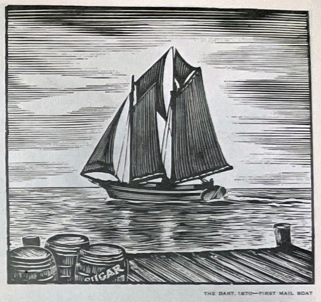
Natural History


Climate of Grand Bahama
The climate of the Bahamas is tropical. A hot and rainy season stretches from May to October and a cooler season from November to April, which is felt more on northwestern islands such as Grand Bahama.
Winter temperatures are pleasantly warm, but temperature can fall when cold air moves in from the north during the winter months. The temperature dropped to 37 °F in January 1977 and there was also a brief snowfall, to 43 °F in January 1981.
Temperature
In a marine climate, there's usually relatively little variation in temperature conditions from month to month or from one year to another.
The hot summer season begins in May and ends in October. Temperatures range from 83°F to 91°F to a minimum of 68°F to 78°F. The average monthly temperature is constant through summer months, particularly from June to September.
Winter temperatures range from 75°F to 65°F on Grand Bahama. Day time temperatures are fairly uniform throughout the Bahamas, but the night or minimum temperatures increase from north to south.
Relative Humidity
Humidity on Grand Bahama is high throughout the year, from a maximum of about 85% at 0700 hours EST and a minimum of about 65% at 1300 hours EST. The amount of moisture in the atmosphere is also remarkably constant.
Prevailing easterly winds exist on Grand Bahama since it is located on the southwest edge of a usual high-pressure area and on the northern edge of the regular trade wind belt, which brings a steady flow of atmosphere from the east.
Clouds and Sun
There is plenty of bright sunshine throughout the year, as the island is part of the high barometric pressure region over the Atlantic Ocean. The average amount of cloudiness is fairly uniform from month to month, with summer and fall months being slightly cloudier than winter months. On average, there are more clouds in October and the least amount of cloudiness in January and February.
Rainfall
The mean annual rainfall on Grand Bahama is approximately 50 inches. About 30% of this, or roughly 15 inches, filters through the porous limestone to recharge the fresh-water lens of the aquifer. The majority of the total annual precipitation occurs in the summer. Rainfall ranges from 2" to 2.5” per month in November and December and from 1” to 2” per month from January to April.
Storms and Hurricanes
Grand Bahama Island is free from violent atmospheric disturbances for the major portion of the year.
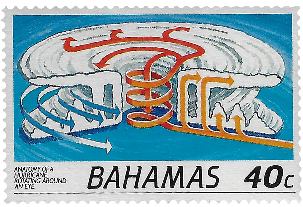
From June through October, the West Indies see many tropical storms. Most of these originate in a belt of equatorial calm about 6° north of the equator called the doldrums, caused by prevailing winds from the northeast in the northern hemisphere.
In the northern hemisphere storms rotate counterclockwise. Most storms exceed two hundred miles in diameter, so many of the storms of the West Indies will have effects on Grand Bahama.
Hurricanes
Two Category 5 hurricanes and seven Category 4 hurricanes have struck the Bahamas since storms were first recorded in 1851.
Hurricanes of the past 20 years:
- Aug 2, 1995 - From the east-southeast, Hurricane Erin stayed over the island as a Category 1 for several hours with 85mph winds resulting in minor damage
- Sept 14, 1999 - Hurricane Floyd with winds of 140mph came from the southeast just east of east end Grand Bahama with minor damage and storm surge flooding.
- Sept 4, 2004 - Hurricane Frances hit with 105 mph winds, a 12- to 15-foot storm surge, and many evacuated. Windows were blown out at the Freeport Crowne Plaza Resort Hotel.
- Sept 25, 2004 – Hurricane Jeanne with 120mph winds hot the island. In 8 Mile Rock, the largest community on Grand Bahama Island, over 75% of the homes suffered serious structural damage, with roofs partially or completely torn off. Many families were relocated to shelters. The eastern half of the island was cut off by storm surges.
- Oct 24, 2005 - Hurricane Wilma with 110 mph winds, with a storm surge sweeping away buildings and roads on the bay side up to 15 feet. Two hundred homes were reported destroyed on the island leaving 1,500 homeless.
- Oct 6, 2016 - Hurricane Matthew passed over the west end of the island with 140mph winds causing heavy damage. On western Grand Bahama Island, an estimated 95% of homes in Eight Mile Rock and Holmes Rock sustained severe damage.
- Sept 1, 2019 – Hurricane Dorian passed over Grand Bahama as a Category 5 hurricane with 180mph sustained winds and extensive storm surge. When Dorian finally turned north on September 3rd at least sixty percent of Grand Bahama Island was left submerged with the greatest damage done to East End. The storm knocked out power island-wide and significantly damaged Stat Oil refinery Floodwaters and sewage contaminated the Grand Bahama International Airport, Rand Memorial Hospital and much of downtown Freeport. The fresh-water lens of the aquifer that is the main supply of water for the island was compromised.
An estimated 13,000 homes, almost half the homes on Grand Bahama and the Abacos, suffered severe damage or were completely destroyed. Damage amounted to US $3.4 billion. There were at least 70 confirmed deaths in the country with many persons remaining unaccounted for.
Hurricane Dorian is regarded as the worst natural disaster in the country's history.
Click here to view Hurricane Dorian damages to Grand Bahama.
Read more on Hurricanes of the Bahamas